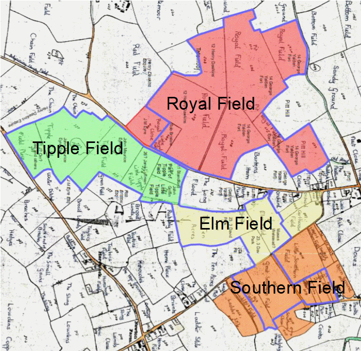
The four fields. The source map here will be clearer and probably more up to date (scroll down to row 3 to see the map on that page)
A Whiteparish local history page from younsmere-frustfield.org.uk
The Whelpley open arable fields continued in use until 1804, when the remaining worked areas were divided between eligible users and enclosed. The Allocation Award document shows the extent of these open fields immediately before enclosure. The four fields, Royal Field, Tipple or Triple Field, Elm or Ellen Field and Southern Field had almost certainly been larger, with some adjacent enclosed fields still bearing the same names in 1842, suggesting that they had earlier been part of the open fields, but subject to earlier enclosure. Other adjacent fields suggest by their shape and position that they might also have been part of these areas. It is very probable that the fields had earlier extended much more widely, but without supporting evidence it is unlikely that any earlier configuration would be accessible to us now. Wikipedia Open Field System is worth looking at for a more detailed account of the open field system.
A copy of the Award map is shown below, together with tracings to help interpretation and the description on this page. The extent of the award has also been overlaid on the 1842 Tithe Commutation Award map and coloured to emphasise the four fields. The source map for the coloured areas is available here and may be more up to date with my latest research than the copy on this page.
Southern Field as shown includes Barn Field that may have been part of Sansoms Farm. Land around Sansoms owned by Countess Nelson in 1842 may include what had been Sansoms Farm, or it may be that just the farmhouse stood here, with Sansoms Down being the rest of the property. However, Sansoms Farm was sold to Giles Eyre 2 in 1661, and in 1842 Sansoms Down was owned by Edward Wynne. It is unlikely that the Eyres would have sold land, so reasonable to assume that Sansoms Down wasn't part of Sansoms Farm in 1661, even if it may have been earlier.
The map below is a section of the 1842 Tithe Map realigned with north at the top with the four open fields coloured and labelled. The blue line indicates the area shared out by the 1804 Allocation Award, while other adjacent fields with the same names or likely to have been part of the fields earlier are also coloured. This map also shows the new owners of these areas, although the names are more visible on the source maps here, which have not been rotated to put north at the top, and therefore, as well as being clearer, have all the text the right way up.
The four fields. The source map here will be clearer and probably more up to date (scroll down to row 3 to see the map on that page)
The map itself is shown in two sections below, northeast area and southwest area. Click on each image for a clearer full screen image. This copy of the map, made for me by the Wiltshire and Swindon History Centre, is somewhat indistint in places, so you may find it easier to view the tracing below. On the tracing, there are question marks where detail is indecipherable, pending the next visit to Chippenham to view the original map.
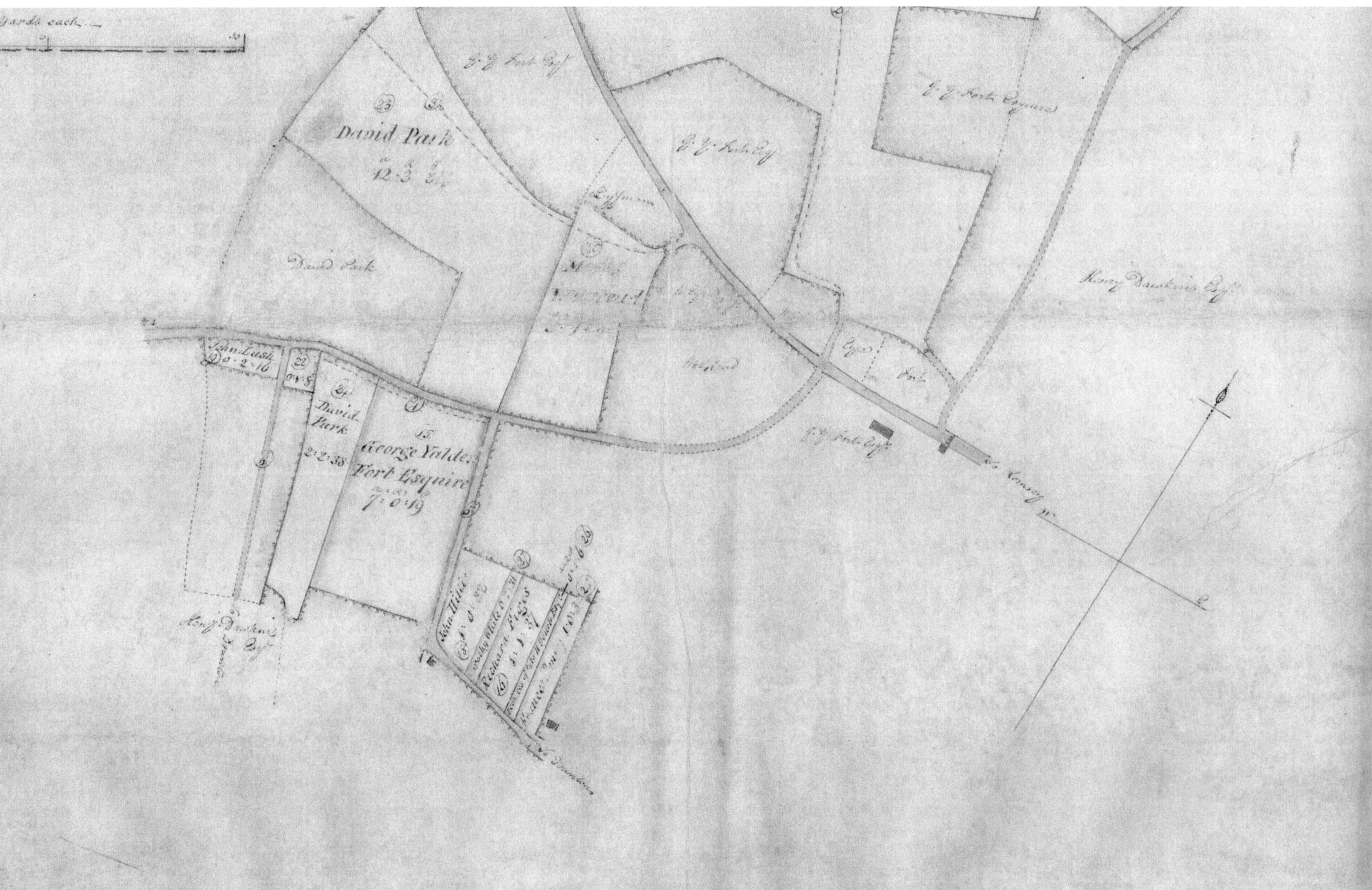

Below the two sections of the map have been put together into a single image and the field, path and road edges and the text traced. The image to the right is the tracing on its own. Click on the images for a clearer full screen view.
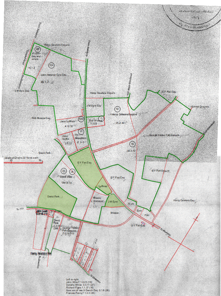
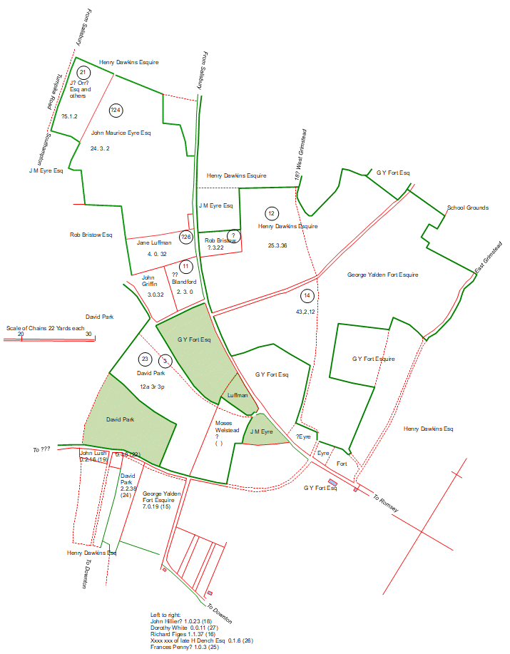
1804 Whelpley Enclosure Award with tracing overlaid, and the tracing alone
Click on the images for a clearer and larger view
Notes:
The two maps of 1804 and 1842 show what happened to the 1804 allocations after they were made.
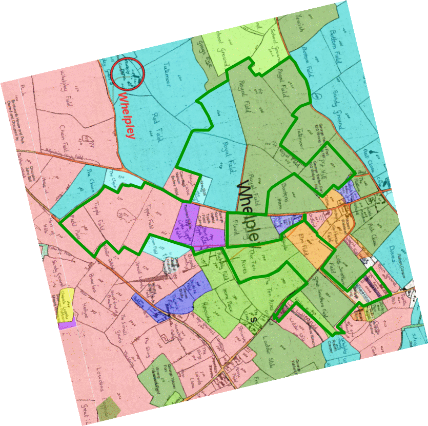
Landowners in 1842, with the 1804 allocation boundary marked
The final image shows the 1804 Enclosure Award boundary tracing from above placed onto a modern Ordnance Survey map. While imperfections in the 1804 survey techniques show up as slight misalignments in places, the accuracy of the original survey is very striking.
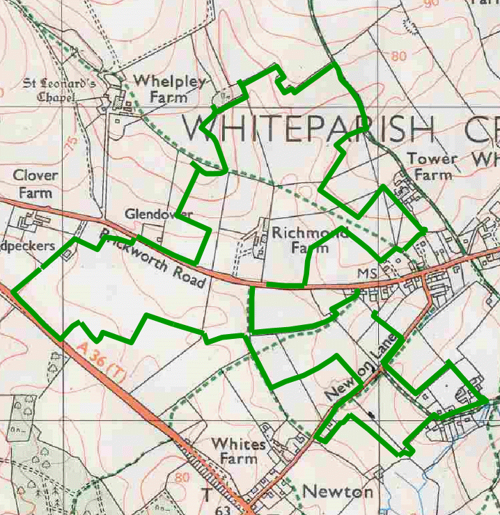
The traced boundary of the 1804 allocation placed over a modern map